


There’s been a lot of buzz over the past few years in the survey and construction industry about PAS128 – the BSI specification for the detection, verification and location of utilities. Now in its fifth year, it is overdue for revision, and there are certainly some good reasons for doing so, technology and expectations have continued to improve and the specification needs to keep pace with new working methods. This is not to detract from this excellent document’s achievements though. PAS128, and its companion document, PAS256, are definitely here to stay.
After a slow start, more and more companies are using PAS128 as their specification of choice when procuring utility mapping surveys. However, as with any new way of working, there can still be some confusion and misconceptions surrounding the PAS128 document.
Some of this confusion arises from the language used – PAS128 is a technical specification aimed at the survey practitioner, so it does have its fair share of jargon that can be difficult to get to grips with on first reading. Other elements that can seem confusing are the different codings used for the various survey types and the different methodologies involved and when to use them. The main confusion probably arises with how PAS128 is supposed to be used. It is not a “fire-and-forget” style specification. It calls for a collaborative process and a new way of working for client and practitioner alike.
Published in 2014 by the British Standards Institution and sponsored by the Institution of Civil Engineers, PAS128 provides a specification for underground utility detection, establishing a standardised approach for the detection, verification and location of buried assets. PAS128 applies to utilities buried no deeper than 3 metres, in urban and rural areas, and on public or private sites.
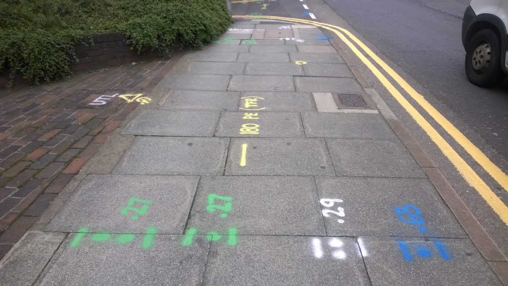
The specification defines four survey categories, relating to different Quality Levels (A, B, C or D). Starting at D, and becoming more detailed and accurate as you progress up the levels, each category of survey adheres to escalating compliance requirements. Each category of survey gives a varying level of confidence in the utility mapping, depending on the detail and accuracy of the final data obtained.
Prior to PAS128, the most widely adopted utility mapping guidance was The Survey Association scheme, which was based on levels of survey numbered from 1 – 6, and this change has led to some confusion in the marketplace. The switch to a letter coded scheme has been inspired by other specifications in use around the world such as ASCE 38-02 in America and AS 5488 in Australia.
There’s more information on the 4 types of survey included in the specification on our dedicated PAS128 resource.
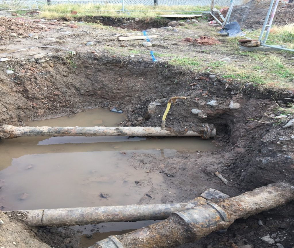
In excess of four million holes are dug in UK roads every year to repair utility assets, install connecting services or lay new cables and pipes.
Location records for older buried assets are often inaccurate or even non-existent leading to service disruptions, third party damage or injury, project delays and increased costs and, ultimately, reduced market confidence in final data integrity and the delivery of utility mapping services.
PAS128 aims, through an emphasis on a thorough investigation methodology and a collaborative approach, to reduce the incidence of dangerous service strikes and costly delays due to unexpected utility hazards.
Whichever survey level you decide on, make sure you choose qualified, experienced surveyors. The survey team should contact you to discuss your project aims, the detection accuracies you require, and then produce a plan and method statement before undertaking the survey. Once the investigation is complete your results will be delivered in a standard report format, and further discussions should take place to make sure all your project aims have been met, or decide if additional investigative work needs to be undertaken.
With varying degrees of confidence in the final data, it’s sometimes tempting to request the highest level of survey in all situations; but this isn’t always necessary. Clients can save time and money by speaking to someone about the right survey type for the project and outputs required.
Contact the Geophysics & Utility Mapping Department at Met Consultancy Group for assistance with all of your utility mapping and site investigation needs. For more information visit our dedicated PAS128 resource.
James [Sam] Roberts FGS FCInstCES DipIOD
Comments Off on PAS128 – A Review