


Geophysics is widely used and popular in disciplines such as archaeology and engineering geology, but also has a host of other applications where knowledge of the shallow sub-surface is required.
It can, for example, enable large areas to be surveyed in a relatively short timeframe, with minimal disruption in comparison to intrusive works.
Using Geophysics as a reconnaissance tool (in advance of intrusive investigations) can greatly reduce the overall cost of site investigations and improve the confidence level of interpretations drawn from your data. In areas where intrusive investigation may be dangerous, geophysics is sometimes the only way to safely gain information about what lies beneath the surface.
Our experienced geophysicists are happy to discuss your requirements and advise on whether geophysics is suitable for your site, and what techniques might best provide the information you need.
Call 0113 200 8900 to discuss your project with our surveying or engineering team
Services include:
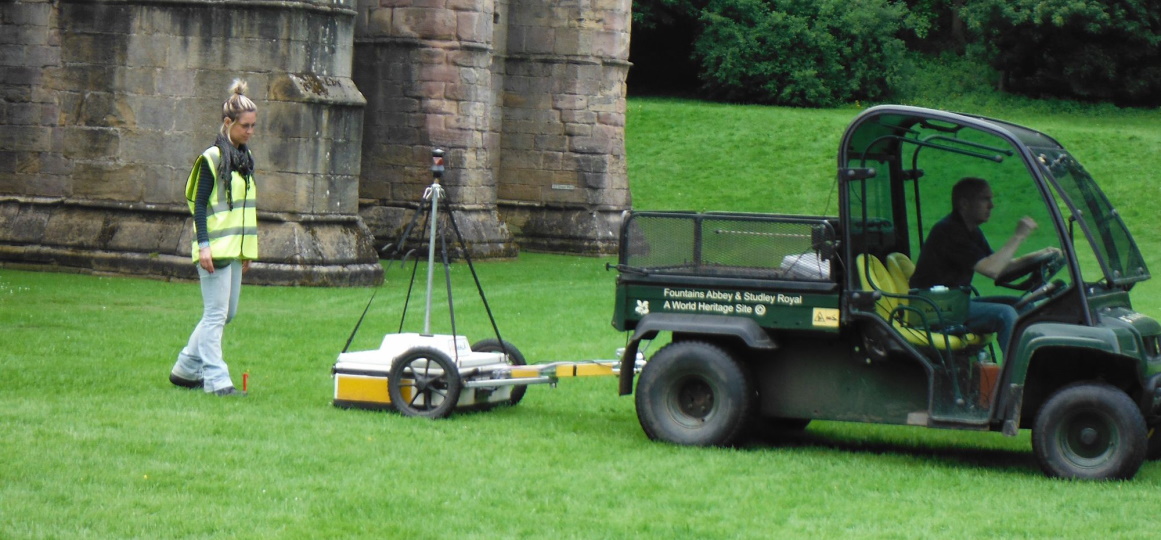
Archaeological Geophysics
Because we employ qualified geophysicists and professional archaeologists, we offer a wider range of survey options compared with many companies who work solely in archaeological geophysics. This means that we are able to offer the best and most suitable techniques dependent on the site, rather than being confined to offering just one or two methods.
Brownfield Reconnaissance
When geophysical surveys are carried out at an early stage they can identify hazards, unusual conditions or buried obstructions that may be hidden within the site. This enables informed decisions to be made on the nature and scope of further site investigations, reducing the risk of unforeseen and costly delays.
Environmental Geophysics
Geophysics can be used to characterise the environmental conditions of a site in a safe and non-invasive manner. This is particularly important when dealing with issues of contamination or if there are specific risks involved with excavation. Typical applications include mapping of contaminant plumes, sinkhole detection and baseline studies in advance of development, amongst many others.
More
Investigations can be tailored to your precise needs, and can either be specific to identifying certain information or more wide ranging reconnaissance style surveys that act as a starting point to identify targets of interest for more detailed characterisation.
Mineshaft Location
The UK has a long and rich history of mining, stretching back thousands of years. However, poor record keeping and illegal extraction has resulted in many areas with unrecorded workings at shallow depth that can be a risk to your development. Our geophysical surveys can help detect and map the extent of any mining activities and can be particularly useful over large areas when identifying targets for intrusive investigation or consolidation.
GPR Survey
Ground penetrating radar is one of the most widely used geophysical techniques. Its versatility allows it to be used for a wide range of applications and in many different settings where other methods are not applicable. It can be used for detecting utilities, voids, structural assessments, forensic applications, road inspections, rebar mapping, bedrock profiling and many others.
More
Met has over 20 years experience working with GPR and our experienced engineers are knowledgeable with its applications, and more importantly the limitations of the technique. We are happy to discuss and advise on any application or survey requirement with no obligation. Contact us for more information or just some free advice.
Void Location
Holes are often problematic – especially when their presence is not known and unexpected. At Met we can employ various geophysical techniques to survey your site for voids and other buried hazards. We can do this in advance of heavy plant or cranes moving to your site, or to map voiding such as old basements, animal burrows or shallow mineworkings. If volume calculations are required we can use other techniques including intrusive works to try and define the size and extent of voiding to allow more certainty in grouting calculations or other remedial measures.
Rebar Mapping
High frequency ground penetrating radar can be used to inspect rebar within concrete and ensure that concrete installations have been successful. It can also monitor the quality of the concrete by identifying fissures and voids, and monitor qualities such as slab thickness. It has many advantages over traditional techniques such as cover meter and Ferroscan™ including greater depth penetration, 3D imaging and the capability to detect multiple layers of reinforcement (dependent upon rebar spacing).
UXO Survey
Geophysical techniques such as magnetometry and time-domain electromagnetics can be used on certain sites to ascertain the presence or absence of UXO-style targets. Several factors need to be taken into account when assessing the suitability of these techniques and our experienced geophysicists will be able to advise you on whether a non-intrusive survey will meet your requirements on a site-specific basis.
Landfill Investigation
Although modern landfill sites are heavily regulated (with landfill gas and contaminating leachates carefully controlled), the situation is not as straightforward for many of the older landfill sites situated around the country. Inadequate records and uncertainty about what is present within these sites means some of them might literally be a disaster waiting to happen. Many of these sites are now grassed over and give little indication for what hazards lie below.
More
Using non-intrusive techniques, Met Geo Environmental can:
• Map out the vertical and horizontal extents of landfill
• Obtain vital information on the areas involved, and
• Calculate the depth of deposits and how the landfill is internally structured.Because these initial techniques are non-intrusive, there is no risk of breaching or harming the landfill, and it avoids any safety issues associated with contamination. Our techniques can also be used in reconnaissance of large brownfield or industrial areas where unrecorded landfill may have taken place