


Desk-based research may suggest what could be present. Historic mapping can show how a landscape has changed. LiDAR or topographical surveys may reveal subtle earthworks. Laser scanning and photogrammetry can create detailed records of historic buildings and standing remains. Geophysical surveys can identify features below the surface, while targeted excavations can finally establish their date, character and significance.
The greatest value comes from combining these techniques as part of a phased investigation, with the findings from each stage informing what happens next.
For many sites, an investigation might follow a sequence broadly similar to this:
The precise approach will depend on the site, its archaeological potential, the heritage assets present, the proposed development and the questions the investigation is trying to answer. Some stages may be combined, others omitted altogether, while particularly complex sites may require several iterations.
The important principle is that an investigation should progressively refine our understanding of the site, rather than simply following a predetermined sequence of techniques.

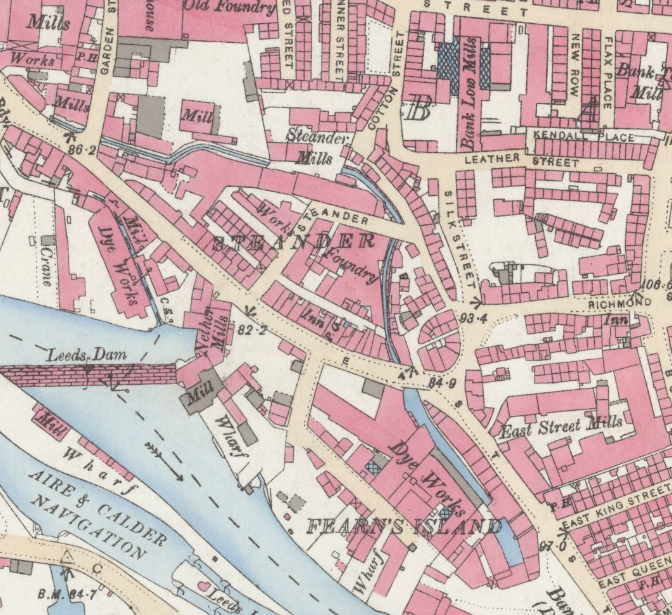
Before going into the field, it’s important to understand what is already known about a site and its surroundings.
A heritage desk-based assessment brings together existing information to establish the site’s archaeological and historic significance.
Sources of information may include:
The objective is not simply to produce a historical narrative, but to identify potential archaeological constraints and help inform the next stages of investigation.
The assessment aims to answer several practical questions:

Historic maps, aerial photography, LiDAR, archaeological records and geological information can be combined in GIS to build a clearer picture of a site’s history and development.
As new survey information becomes available, it can be incorporated to refine our understanding of the site, identify potential archaeological features and guide further investigation.
Comments Off on Heritage & Archaeology – A Phased Approach to Site Investigation