


Met Consultancy Group has been undertaking land surveys across the UK and Europe for over 40 years’ and continually invests in the latest surveying technology.
A land survey determines the critical dimensions of an area and its physical properties (i.e. boundaries, surfaces, gradients). Undertaking a land survey is crucial when looking to develop a site as it’s the first step to understand what is on your site and the development options available to you.
There are different types of land survey dependent on the area that needs investigating however, each sets out to understand the “lay of the land” and any restraints this may cause.
At Met, we undertake all types of land survey from garden/extension to a home, brownfield site to town centre. All information is turned into 2D or 3D drawings enabling design teams to develop new schemes or make changes to existing infrastructure.
Along with this, our surveyors can undertake other surveys in parallel such as utility, measured building or structural surveys as we offer a range surveying, geophysics and engineering solutions.
Call 0113 200 8900 to discuss your project with our surveying team.
Services include:
Inland Waterways
Met Consultancy Group provides risk assessment and design services incorporating flood prevention measures for all types of developments, specifically designed to meet EA planning and requirements. Our inland waterways engineering and survey teams have extensive experience of flood risk and hydrogeological assessments ranging from river surveys to investigating the lay of the land and the condition of existing drainage systems.
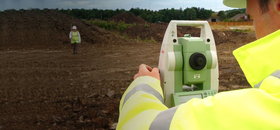
Topographical
Met Consultancy undertakes topographical surveys across a wide range of sites from small development schemes to large scale town centre developments. Our clients vary from local architects and engineers to international contractors and developers. We can advise you on appropriate technology and techniques for your specific site conditions.
Railway
Our railway services include track, embankment, bridge, tunnel, station and platform surveys, monitoring, gauging, drainage, CCTV and utility mapping. As an audited RISQS (formerly Link-up v2) registered supplier our surveyors and geophysicists are Personal Track Safety (PTS) qualified with the experience to work on a variety of railway projects.