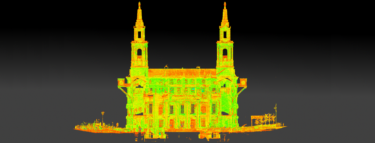
Our team of laser scan surveyors use 360° scanning equipment in both external and internal environments to create accurate models of buildings, structures and landscapes.
Whilst Laser scanning is still in its infancy it is fast becoming the method of choice for carrying out accurate surveys. Laser scanning is ideal for use on sites where detailed 3D measurements need to be recorded, the working environment is hazardous or of a time sensitive nature.
The laser scanner captures information by measuring and coordinating many thousands of points of data per second, into what is generally referred to as a point cloud. The point cloud consists of millions of geo-referenced discrete points, which can be manipulated to create a variety of different outputs. After collecting laser scan data our team of surveyors can create outputs ranging from a basic 2D CAD drawing to a comprehensive 3D Revit model.
Ideal for anything from mechanical plant rooms though to historical monuments and buildings, 3D models created from the laser scan can then be used by architects, developers, engineers, and other end users, to accurately plan, design and develop from.
At Met, we provide a full laser scan service, from data collection on-site, to processing and modelling back in the office. We can deliver point clouds and Revit models as well as using laser scanning to complete measured building surveys. By combining laser scanning techniques with a high definition camera we can also create true-colour point clouds and realistic fly through.
If you have any project requirements that may benefit from laser scanning, please get in touch to find out how we can help.
Benefits of 360° laser scanning:
- Create fast, accurate digital models of buildings, structures and landscapes
- Capture of very complex detailing
- Suitable for reduced access sites
- Quick collection of data on-site
- Reduced health & safety risks on-site
- Detailed 3D model capability
- Fully aligned digital photography and 3D point cloud
- Ability to interrogate 3D point cloud data (no return site visits)
Contact us to request a quote using the form below, or call us on 0113 200 8900 to discuss your requirements.
Services include:
2D CAD drawing
Data can be manipulated into a variety of outputs, including basic 2D CAD drawing with relative ease. Perfect for fast, accurate, digital modelling where site access or hazards make it difficult for other techniques to be used.
3D Revit modelling
Quick collection of data means point clouds can be generated easily and efficiently, allowing comprehensive 3D Revit models to be produced.
Measured building
Accurately measure buildings and sites which are hazardous, intricate or otherwise difficult to access.
Fly through
By coupling laser scanners with high definition camera images we can create powerful fly through models and true-colour point clouds for in-depth design and planning.


