17th March 2015
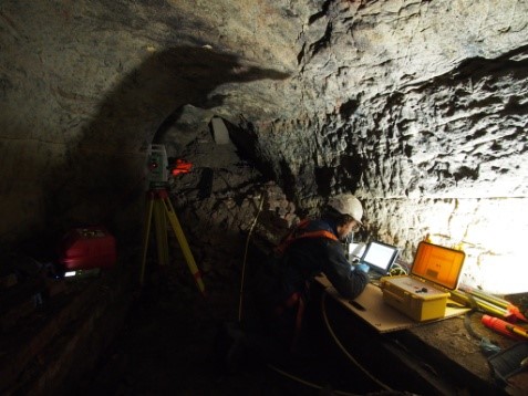 Met Geo Environmental’s confined space qualified survey team has completed a series of investigations of some of the oldest man-made cave systems in Britain.
The team was called in to support the latest stage of an archeological survey of the ancient cave system beneath Nottingham city centre. There are around 500 man-made caves carved into the sandstone beneath Nottingham, the oldest dating from the 13th century and the most recent from the Second World War when they were dug out to serve as air raid shelters and radium stores. In the intervening 500 years they have been used as dwellings, beer cellars, cess pits, tanneries, sand mines, kilns and follies.
The survey was slow and ongoing, taking in one cave at a time as decades of soil seepage from the roof voids had rendered some areas of the cave systems inaccessible to physical investigation.
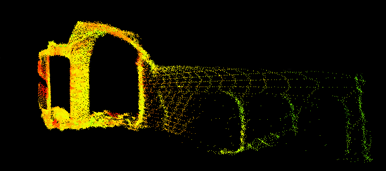
We completed three site investigations of the inaccessible spaces using Cavity Auto Scanning Laser System supplied by MDL Renishaw to capture void data. C-ALS is a 50 mm diameter laser scanner that can be deployed in to inaccessible voids and open spaces via small holes. Like a conventional laser scanner C-ALS uses a laser to record the distance and angle to millions of points to form a three dimensional point cloud. The added advantage of the C-ALS is that it can be operated remotely, so there is no requirement to enter the confined space.
Back at base, the point cloud data was imported to Cloudworks and converted to 3D CAD models to provide a fully imaged model and measurements of the inaccessible cave structures.